
By: Joshua Wisel
FAYETTEVILLE, Ark (UATV)- It’s Friday, which means we’ve made it to another weekend here in Fayetteville, and weekends mean football! Even though the game is in Dallas, we’ve still got you covered regarding the forecast!
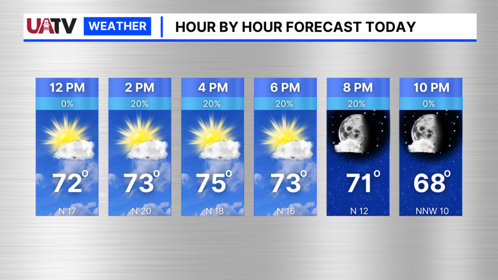
To start, we’ll look at our local forecast for Fayetteville. Today another mostly sunny fall-like day is expected. However, by later today there could be some low rain chances and increasing clouds as the low pressure to our east continues to slowly shift, but not fully leave the region.
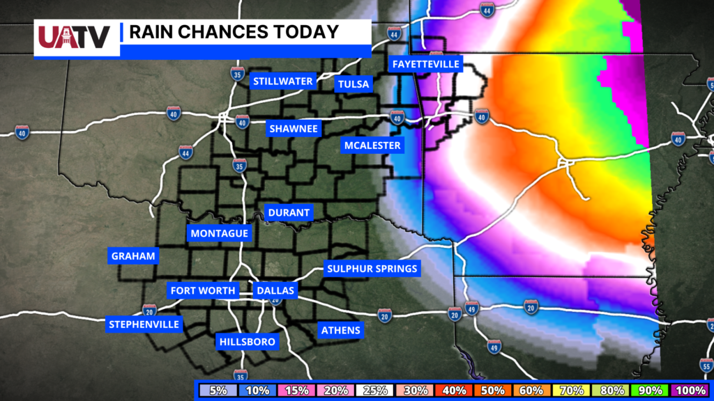
The reason we’ve had off-and-on clouds and some patchy rain across the area is because of this large low-pressure system to our east near Memphis. Why it’s not moving very quickly is because Helene is moving north from Florida, and now merging with this low-pressure system in an almost “Fujiwhara Effect” like fashion. However, because both systems are rotating from upper levels of the atmosphere and not closer to the surface, it’s not technically a textbook Fujiwhara effect, yet it is something cool to see on visible satellite and vorticity imagery. Now, because these systems are merging, the swinging bands of energy could clip our area over the next 48 hours leading to some shower/t-storm development. Yet it doesn’t appear to be likely we see full area rain coverage or a washout for us.
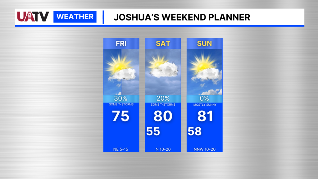
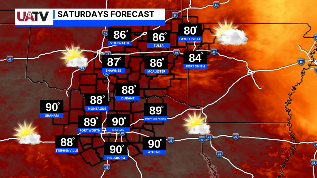
For the remainder of our weekend, we can expect fall-like conditions across the area with highs warming into the lower 80s by Saturday and Sunday. Lower rain chances will continue through tomorrow, and tomorrow expect partly sunny skies.
Now for anyone traveling to Dallas, here is the travel forecast for this weekend, so you can prepare for the trip, and the days ahead!
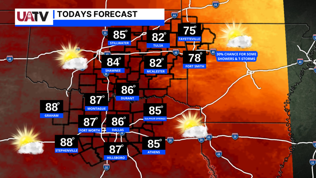
If you’re traveling to DFW today, it will be a great day to do so. Dallas is expecting mostly sunny skies today with highs in the upper 80s, and overnight lows in the lower 60s. Slight rain chances will exist today across Northwest Arkansas while leaving, decreasing the further west you go while traveling.

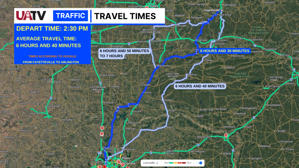
If you’re planning on traveling this afternoon here’s a look at what travel times could look like for travelers today if they leave by early afternoon. Overall travel conditions ahead look to be clear the majority of the way, with nice weather, and according to the maps, not much, but typical traffic construction along the way. No major projects or shutdowns were reported.
For Saturday the forecast looks great, but warm for the Razorbacks VS Aggies Game tomorrow afternoon. For the morning into mid-day if you plan to tailgate the weather will be great for outdoor activities!
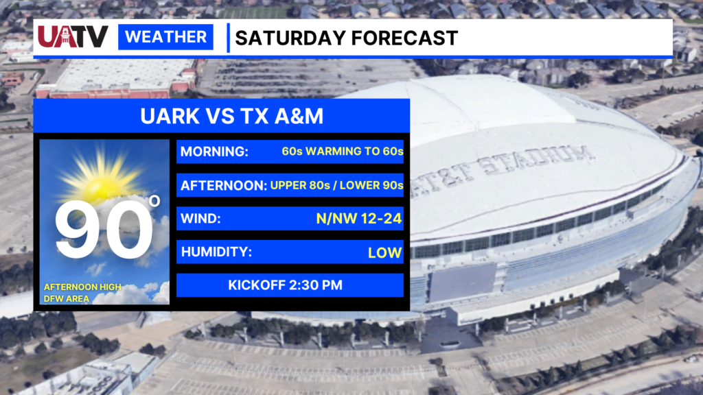
Afternoon highs will reach the upper 80s to lower 90s, with mostly sunny skies. Winds outside of the stadium will reach up to 12-24 mph, so some tailgating lose items could get blown around or off the table at times, so keep that in mind. This will have no impact on the game with it being held inside. For more DFW forecast information follow my media for the latest, as i have been forecasting for the DFW area for over 10 years now. And for tomorrow we hope you have a great gameday, GO HOGS!
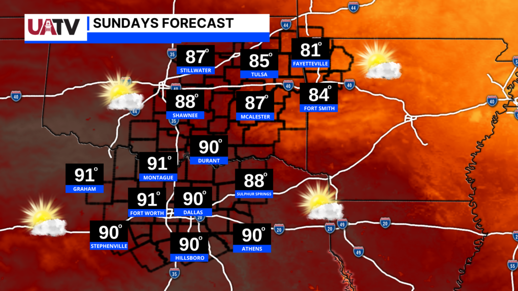
SUNDAY:
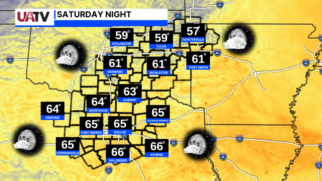
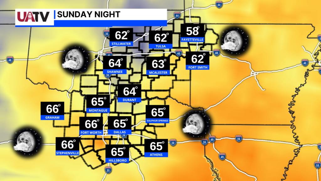
For Sunday the weather for traveling home will be good, as mostly clear skies and temperatures in North Texas in the lower 90s, and mid to upper 80s through Central and Wester Oklahoma into Northwest Arkansas. Sunday night into Monday morning expect lows across the region in the upper 50s to lower 60s.
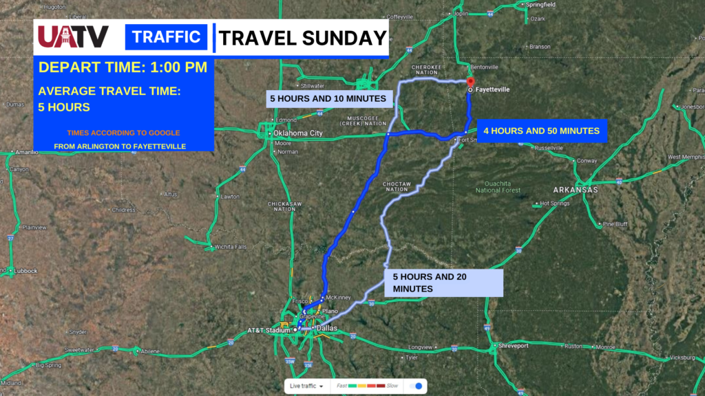
Travel times for the journey home will be averaging about 5 hours from Arlington to Fayetteville, with the fastest route looking to be about 4 hours and 50 minutes. Again like the journey down, we aren’t aware of any major closures or projects over the weekend, besides some areas of normal construction for these routes.
Overall we hope you have a fantastic weekend whether you’re staying in town, or traveling to Dallas. Enjoy this beautiful weather, and GO HOGS! And remember to tune in for daily updates to our UATV Weather Page!
Extended 7 Day Planner: