
FAYETTEVILLE, ARK- Good day Northwest Arkansas! It’s a new week, but the weather for the time being continues to remain the same with hot and humid conditions continuing. For today (Monday) highs are expected in the lower to mid 90s in Northwest Arkansas, with dewpoints in the mid to upper 60s. Heat lasts but not for long! We have cooler temperatures and some rain chances on the horizon!
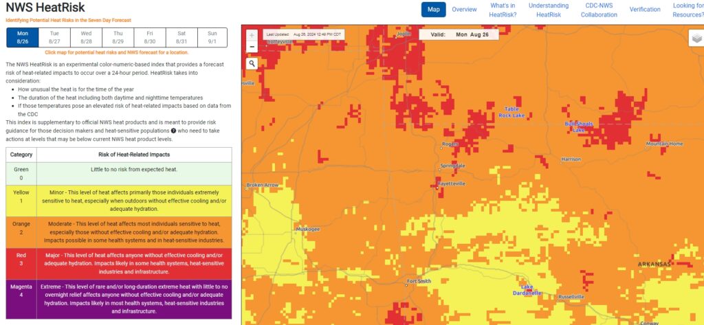
Because of the heat and humidity mixing across the area today, there is a widespread area of Moderate to Major heat impacts across the region on the National Weather Service Heat-Risk Forecast Map. Click here to view the NWS Heat-Risk Map.
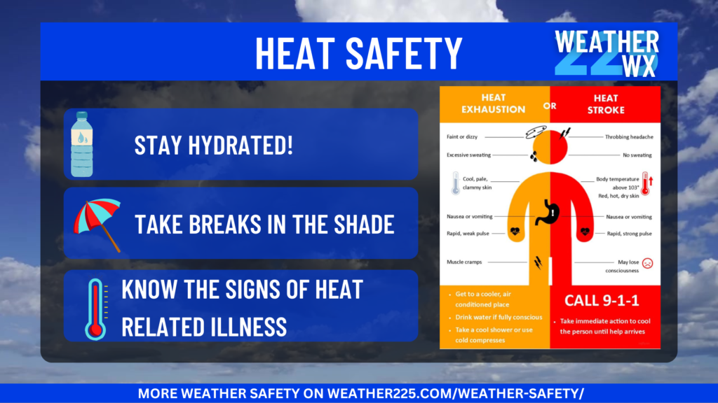
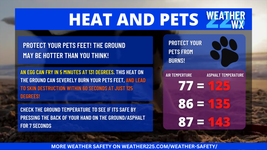
So because of the risk for heat impacts across Northwest Arkansas, make sure you’re staying hydrated, take breaks in the shade, and DON’T leave pets or kids alone in an unattended vehicle! And remember the heat on the ground during the afternoon will be too much for your pets paws. The best times to walk your pets are earlier in the morning, and later in the evening when the surface is cool enough for their paws. Here’s some heat safety information:
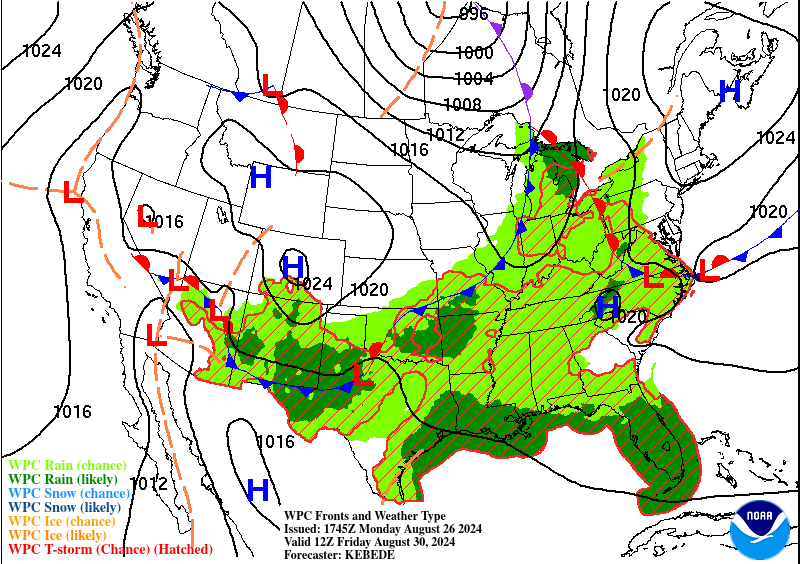
The heat will remain for the next few days, however, relief is on the way! By late week another system will push through the region, with rain chances from Thursday night into Sunday. So prepare for potential rain chances by Thursday, and continue into your Labor-Day weekend.
Here’s the latest extended Forecast:
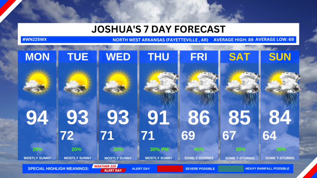
This Afternoon
Mostly sunny, with a high near 94. South wind around 5 mph.
Tonight
Mostly clear, with a low around 72. South wind around 5 mph becoming calm in the evening.
Tuesday
Sunny, with a high near 94. Calm wind becoming southwest around 5 mph in the afternoon.
Tuesday Night
Mostly clear, with a low around 71. Calm wind.
Wednesday
Sunny, with a high near 93. Calm wind becoming southwest around 5 mph in the afternoon.
Wednesday Night
Mostly clear, with a low around 72. South wind around 5 mph becoming calm.
Thursday
A 20 percent chance of showers and thunderstorms after 1pm. Mostly sunny, with a high near 93. Calm wind becoming south around 5 mph in the morning.
Thursday Night
A 20 percent chance of showers and thunderstorms after 1am. Partly cloudy, with a low around 70. South wind around 5 mph becoming calm in the evening.
Friday
A 50 percent chance of showers and thunderstorms. Partly sunny, with a high near 85. Calm wind becoming west around 5 mph in the afternoon.
Friday Night
A 20 percent chance of showers and thunderstorms after 1am. Partly cloudy, with a low around 68. Northeast wind around 5 mph becoming calm.
Saturday
A 30 percent chance of showers and thunderstorms. Mostly sunny, with a high near 86. Calm wind becoming northeast around 5 mph in the afternoon.
Saturday Night
A 20 percent chance of showers and thunderstorms. Partly cloudy, with a low around 66. East wind around 5 mph becoming calm in the evening.
Sunday
A 30 percent chance of showers and thunderstorms. Mostly sunny, with a high near 85. Calm wind becoming east around 5 mph in the afternoon.
Have a great start to your week!
-Joshua Wisel